Welcome to the Aloft Aerial Photography Blog. Our goal is to show you some interesting aerial shots and give you information about them as well. All the photographs that we use are available for sale and are just a small part of our growing collection. Hunter H. Harris is our Photographer and flies often so be sure to check back often for new photos.
Garrett Island on the Susquehanna River
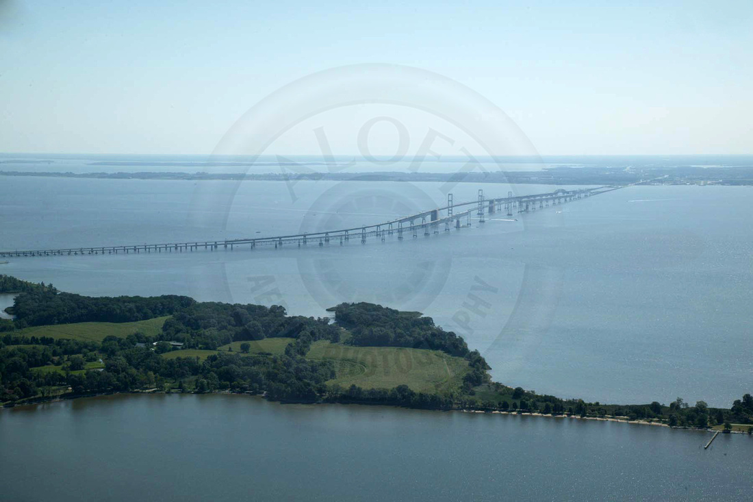
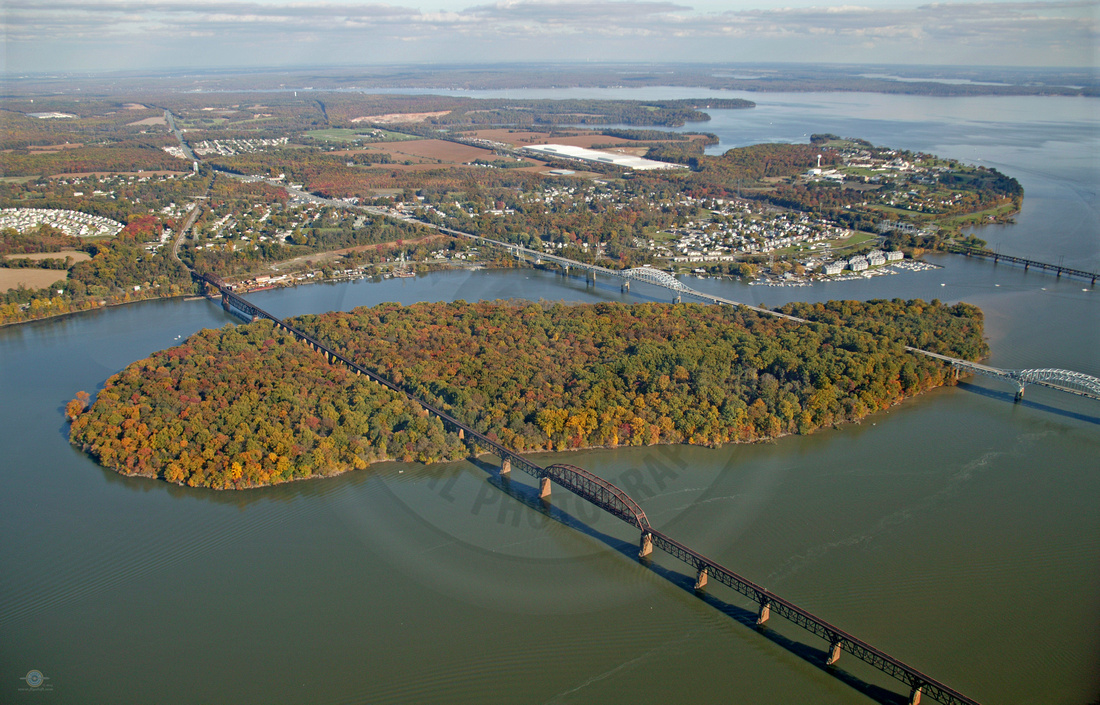 Garrett Island BridgesBridges across the Susquehanna River with a view of the town of Perryville in Hardford County, Maryland. The first bridge is a Amtrak Train Bridge, the second is the Thomas H Hatem Memorial Bridge, and the third is the B&O Railroad Bridge. The Amtrak and Memorial Bridge cross Garrett Island.
 Garrett Island, which covers 198 acres, was originally inhabited and settled by the Susquehannocks – the “tall, majestic” Native Americans to the north. John Smith may have visited the island in 1608 but there is no definitive documentation proving this. In 1622, the island was given to Edward Palmer as part of a land grant by King James I, and the earliest documented European presence dates to 1637 when William Claiborne established a trading post on the island. In the same year, Maryland troops evicted Claiborne's Virginia traders from the Upper Chesapeake region and built Fort Conquest on what was then called "Palmer's Island."During the later colonial period, the island was farmed by a family named "Watson" and it eventually came to be called "Watson Island." Watson Island was purchased by the Baltimore and Ohio Railroad (B&O) in the 1880s so a bridge could be built across the Susquehanna River at that point. The island was named after John W. Garrett, then president of the railroad.
Not much has happened on Garrett Island since. Over the years there have been a number of schemes to develop the island in various ways: condos, amusement parks, etc. A lot of public pressure evolved to insure that Garrett Island would never actually be developed.
This protection came just a few years ago when the U.S. Fish and Wildlife Service purchased the island and designated it a wildlife refuge. It is now part of the Chesapeake Marshlands National Wildlife Refuge Complex. The Chesapeake Marshlands National Wildlife Refuge Complex is located on the Eastern Shore of Maryland and Virginia. It is the most complete network of protected lands in our Nation’s largest estuary. It shows the importance of the natural world to the quality of human life; the value of, and need for, fish and wildlife management; and the human role in preserving and enhancing wildlife habitat. The Chesapeake Marshlands National Wildlife Refuge Complex includes the Blackwater National Wildlife Refuge (NWR), Eastern Neck NWR, Martin NWR and Susquehanna NWR. Other parts of the Complex are the Barren Island, Watts Island, Garrett Island, Bishops Head, and Spring Island Divisions.
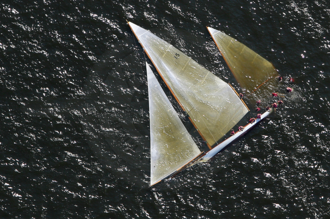
Log Canoe Races on the Chesapeake Bay
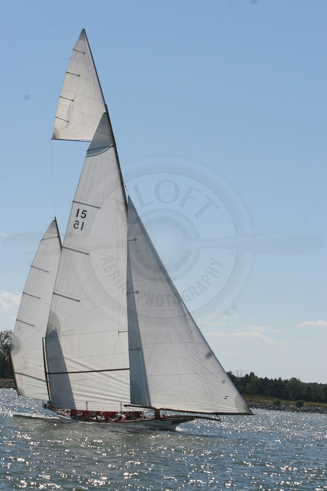
Originally built by the native Powhatan tribes along the Chesapeake Bay, these boats were adopted by early English settlers, who discovered that the sturdy craft could handle the rough waters of the Bay and carry a heavy load. For more than three centuries, the log canoe was essential to life on the Chesapeake Bay, the United States’ largest estuary, for travel, harvest and trade. The suitability of this open, shallow vessel for navigating and fishing along the Chesapeake waterways led to its adoption and assimilation by European colonists using imported tools and technology.
Beginning in the 1840s, log canoe racing was a spinoff from workboats racing one another between oyster bed and market to get the best price for their goods. A massive sailing rig was added to a Tilghmans Island canoe hull, thinned to reduce weight, transforming the workboat into a racing vessel. The outrageous amounts of canvas to increase speed resulted in a problem: in a strong wind the boat can tip. This necessitated windward ballast upon which a canoe’s crew could sit on and use their body weight to counterbalance the craft.
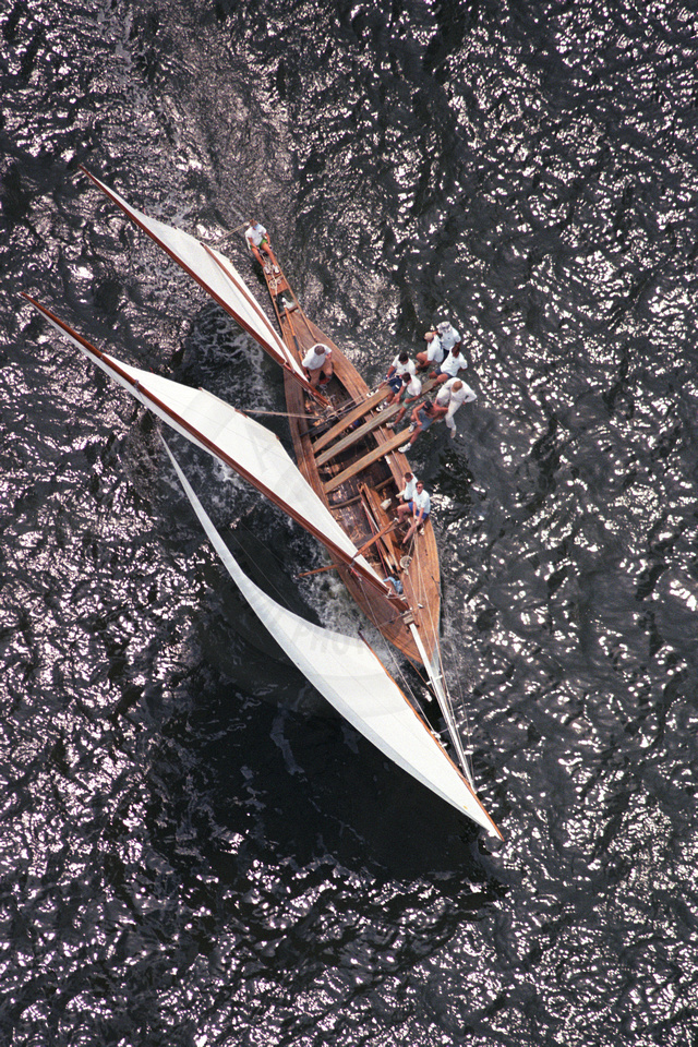
The early 20th century saw the construction of purpose-built racing boats as well as organized racing competitions in the northern Chesapeake Bay. These races became a annual organized competitions that were and continue today to be held in the Chesapeake Bay, where the crews pit themselves against each other and the wind in order to reach the finish line.
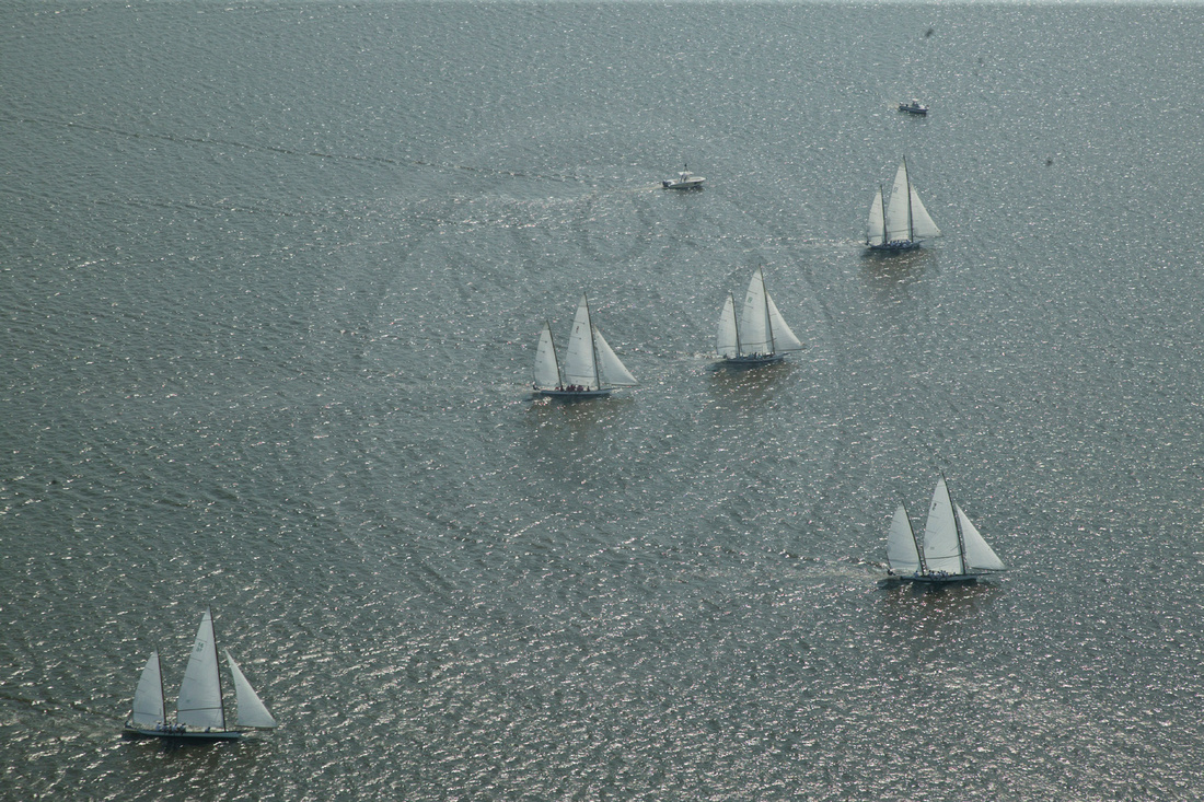
While there may not be many of these boats still racing today, those that do race they have a fearless breed of sailor for crew. In order to balance out the wind in the enormous sails these crews climb out on windward ballasts over the water with nothing keeping them there but their strength and determination. Though at times even that is not enough and the sails and the sailors meet the water instead of the finish line. If you ask them about their boats they will say there is no other like them and they are worth the challenge.
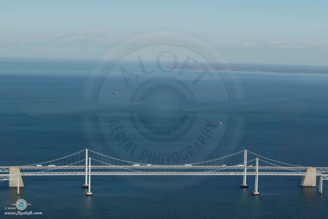
Chesapeake Bay Bridge Through the Seasons
Aloft Aerial Photography flies the Chesapeake Bay hundreds of times a year and as a result has a large collection of aerial photographs of the Chesapeake Bay Bridge.
The Chesapeake Bay Bridge, which takes Route 50 across the Chesapeake Bay between the Kent Island and Annapolis areas, is officially named The William Preston Lane Jr. Memorial (Bay) Bridge – but most locals refer to it simply as the “Bay Bridge,” or sometimes the Chesapeake Bridge. The Bridge is 4.2 miles long – one of the longest over water structures in the world. The Bay Bridge is actually two side-by-side bridges with two lanes of traffic on each span. The first bridge (eastbound span) opened in July of 1952 and the second bridge (westbound span) opened in June of 1973.
The Bay Bridge is named after William Preston Lane, Jr., who was the 52nd Governor of Maryland when construction of the first span began. The first bridge had two lanes, was opened on July 30, 1952, and cost $45 million. The second bridge had three lanes, was a "modernized look alike", and cost $148 million.
A shot of the Center of the Chesapeake Bay Bridge including both the East and West Bound Spans taken January 9th, 2003 and published in July of 2006. It was shot with a Cannon EOS-1DS with a focal length of 70mm, exposure was 1/400 @ f/14 with an ISO Speed of 200.
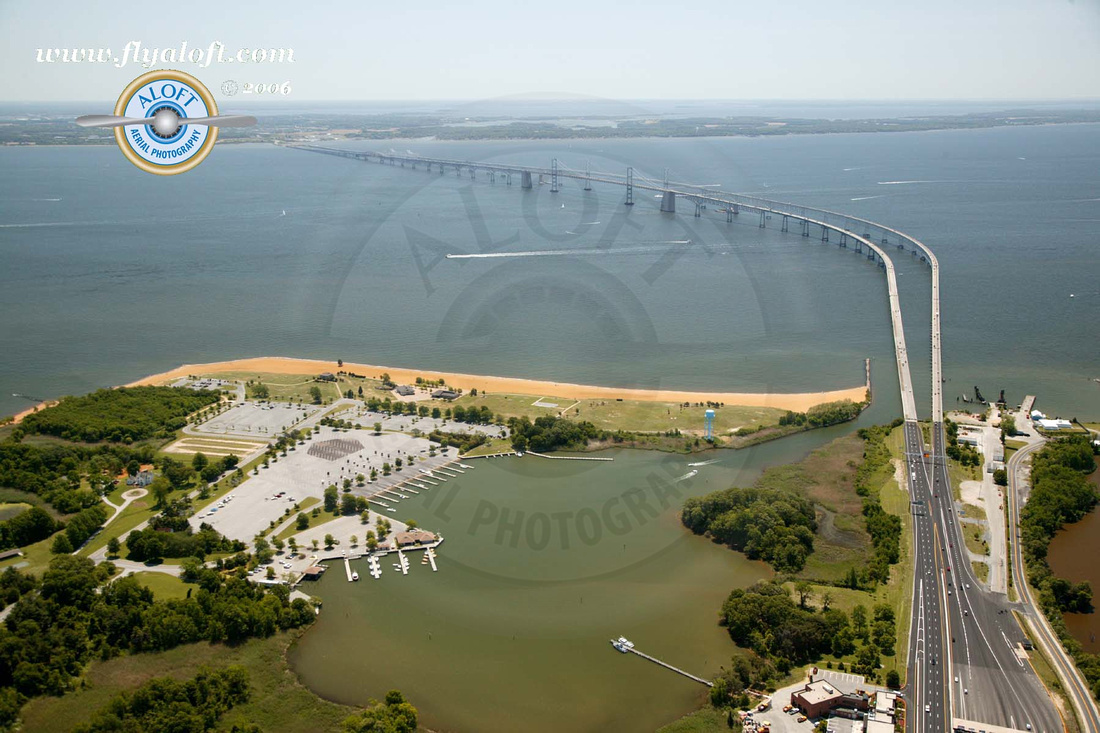
Chesapeake Bay Bridge from the Western Shore of Maryland on May 21st, 2006 with a view of Mezick Ponds and part of Sandy Point State Park in the left corner. This picture was taken with the Cannon EOS- 1DS with a focal length of 32mm and a exposure of 1/500 @ f/5 with a ISO speed of 400.
A photograph from Whitehall Creek, near Hackett Point on the Western Shore of Maryland, with the Chesapeake Bay Bridge in the background. Also visible are Goose Pond, Moss Pond, Love Point, and the mouth of the Chester River. The photo was take on August 16th, 2006 with a Canon EOS-1DS , set with a focal length of 55mm with a exposure of 1/400 @ f/11 and had a ISO speed of 400.
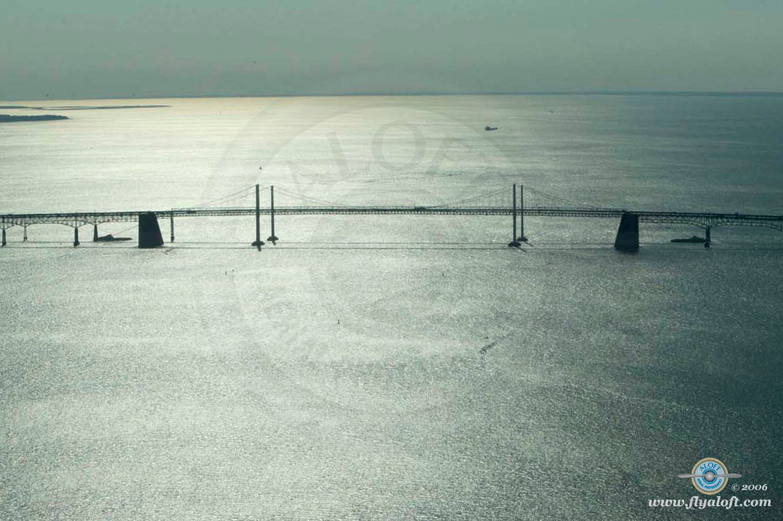
The East and West Bound spans of the Chesapeake Bay Bridge on November 10th, 2004 with very little water traffic. Shot with the Cannon EOS-1DS with the settings of focal length of 70mm, exposure 1/500 @ f/20, and ISO speed 200.
Naval Academy in Annapolis, MD
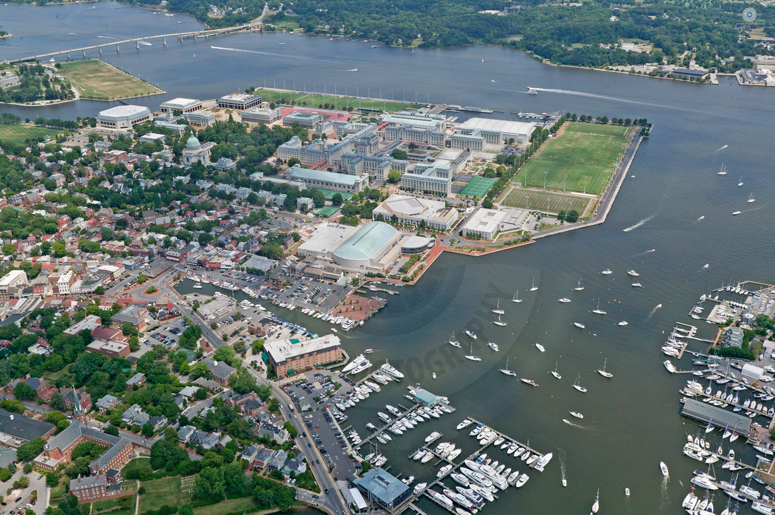
The United States Naval Academy on the Severn River, Annapolis, MD. This image is an aerial view from an altitude of 1300’ of the main campus of the USNA. Also visible are both Spa Creek and College Creek , the Severn River and downtown Annapolis, all surrounding the academy. A few other points of interest are: Rip Miller Field (upper right corner), the Annapolis Yacht Basin, Severn Sailing Association, the (undamaged) Annapolis Yacht Cub (bottom of the image), Halsey Field House and Bancroft Hall (center of the image).
Here is a link to a good map and a great cross reference for this image showing the USNA. http://www.mappery.com/map-of/United-States-Naval-Academy-Map
When the founders of the United States Naval Academy were looking for a suitable location, it was reported that then Secretary of the Navy George Bancroft decided to move the naval school to "the healthy and secluded" location of Annapolis in order to rescue midshipmen from "the temptations and distractions that necessarily connect with a large and populous city." The Philadelphia Naval Asylum School was its predecessor. Four of the original seven faculty members came from Philadelphia. Other small naval schools in New York City, Norfolk, Va., and Boston, Mass. also existed in the early days of the United States. Since that time the naval academy has had a rich history.
This image was captured back in July of 2009. It is just one example of the many aerial images of the Chesapeake Bay area taken over many years by Aloft Aerial Photography. www.flyaloft.com
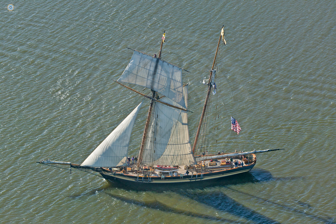
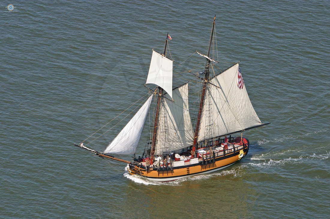
Chestertown Downrigging Festival
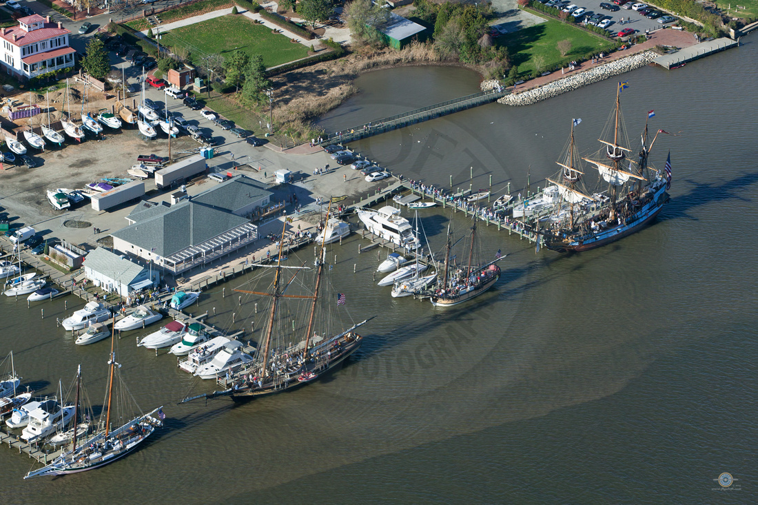
These aerial photographs were taken in 2009 by Aloft Photography of the Chestertown Downrigging Festival. Many Historic ships docked in the two block area of the Chestertown Waterfront in Chestertown, Maryland for the Downrigging Festival. In 2009 Four of the Ships who participated were the Lady Baltimore, the Pride of Baltimore II, the Sultana, and Kalmar Nyckel.
As of the autumn of 2015, Sultana’s Downrigging Weekend Tall Ship and Wooden Boat Festival has evolved into one of the largest annual Tall Ship gatherings on the East Coast. It all started back in November, 2001, when the newly launched schooner SULTANA and the PRIDE OF BALTIMORE II, took a casual sail together on the Chester River the weekend before both vessels “downrigged” for the winter. The combination of a stiff breeze, the fall colors at their peak, and thousands of waterfowl flying overhead, made it a day few on board either vessel would soon forget. “We’ll have to do this again next year,” remarked both Captains – and so Downrigging Weekend was born.
The Sultana
The Pride of Baltimore II