Thank you for your patience while we retrieve your images.
Taken 22-May-06
Visitors 3


4 of 28 photos
Thumbnails
Info
Categories & Keywords

Category:
Subcategory:
Subcategory Detail:
Keywords:Aerial Photography, Aloft Aerial Photography, Chesapeake Bay, Chester River, Chestertown, Chestertown%c Md, Eastern Shore, Historic Towns, Kent County, Maryland History
Photo Info

Dimensions1800 x 1200
Original file size247 KB
Image typeJPEG
Color spaceAdobe RGB (1998)
Date taken22-May-06 08:37
Shooting Conditions

Camera makeCanon
Camera modelCanon EOS-1DS
FlashNot fired
Exposure modeAuto
Exposure prog.Shutter priority
ISO speedISO 400
Metering modePartial
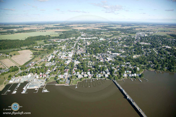
Chestertown, MD in Kent County

Chestertown, MD in Kent County

The seat of the Eastern Shore's oldest county Kent was finally put at its present location on the Chester River in 1706. Beginning with a Governor's proclamation in 1668, there had been intermittent proposals to establish a colonial port at about this spot on the river. Doubtless the building of a county court house on the present grounds by 1697 all but assured the founding of the town. Faulty provisions for the sale of the land and other setbacks caused the Legislature in 1730 to order a careful surveying of the Town's 100 acres and the laying out of the logical and functional plan which we continue to enjoy to this day.